
GIS & spatial analysis
Pacific Infrastructure Group develops GIS datasets, spatial analysis and mapping for infrastructure and development decisions. We bring survey, asset, environmental and planning information together to reveal constraints, compare options and explain the relationships across a site or region.
Turn location data into useful project understanding.
A map is only as useful as the information and assumptions behind it. Pacific organises spatial data around the questions a project needs to answer, checking coverage, references and fitness for use. We analyse relationships such as corridors, proximity and constraints, then present the findings in maps and datasets that support design, assessment and discussion without hiding uncertainty.
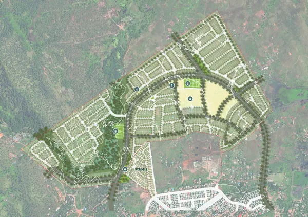
What we do
Our capabilities
We connect data organisation, analysis and communication around a defined project question.
Data organisation
We bring source datasets into a consistent structure with their references, ownership and limitations recorded. This helps the team understand the available evidence and reduces ambiguity when information from different sources is combined.
Spatial analysis
We examine corridors, proximity, constraints and project options against the agreed decision framework. Analysis helps make relationships visible and allows the team to compare alternatives using a consistent spatial basis.
Mapping and handover
We prepare clear maps and usable datasets for project teams and stakeholder discussions. Supporting documentation explains the sources and assumptions so the information remains understandable when used in later work.
What you receive
Deliverables
GIS outputs should communicate the findings and preserve the information needed to understand or develop the analysis.
Organised spatial information with consistent references and source notes. It provides a usable foundation for project analysis, mapping and further work.
Maps showing the spatial relationships relevant to a decision. They help clients and project teams compare alternatives and explain the basis of an approach.
Documentation of data sources, references, assumptions and limitations. It supports consistent use of the information and makes future updates easier to understand.
Working with Pacific Infrastructure Group
Value for your project
Evidence seen together
Bring different spatial sources into a common view of the site or project area.
Clearer comparisons
Use location-based analysis to understand the relationships and constraints affecting project options.
Information that travels well
Keep the sources and assumptions with the data so other team members can use it with context.
Other services
your project may need.
Talk to Pacific Infrastructure Group
Discuss your
requirements
Tell us the decision you need to support, the project area and the spatial information available. We can discuss the analysis, mapping and handover required.
This site is protected by reCAPTCHA.