01 / Context
Understand the land first.
Waterways and flood behaviour shaped the planning challenge. Sensitive land added another consideration. Infrastructure interfaces also influenced how development could be arranged across the site. Understanding these conditions provided the starting point for the plan.
02 / Response
Let constraints guide the plan.
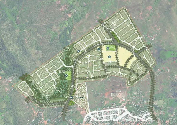
The masterplan responded to the site’s environmental conditions. These informed the arrangement of development and open space. Infrastructure was considered alongside those areas. Bringing these relationships together allowed site constraints to guide the planning direction.
03 / Perspective
A clearer basis for decisions.
The published masterplan illustrates a planning proposal for the site. It shows how early attention to site conditions can inform development decisions. The proposal provides a basis for considering the arrangement of development, open space and infrastructure. It represents the planning work, rather than a completed built outcome.